Google Maps Link
https://www.google.com/maps/@44.50257,-75.1709563,603m/data=
The falls were named after a Mr. Hart, from the Canton area, who ran a mill here. Records are unclear if it was a grist mill or sawmill. Both were vital to the settlement of the area at that time. He was a veteran of the Civil war and started this enterprise after the war, probably sometime around 1865. There are still remains from the mill easily visible – a hand laid stone wall and the flume that would have diverted river water to the water wheel.


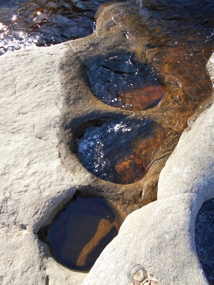
The flume was blasted out of the flat rock that makes up the falls. It sits between the main flow of the falls and a field that is now returning to brushland, as the property has not been an active farm in some time. The flat rocks have several glacial “pot-holes”, a unique geologic feature in the area.

St.Lawrence land trust
The falls had been privately owned until 2015, when it was turned over to the St.Lawrence land Trust, by the Kelly family. It is now open to the public, and I’m sure you’ll see some improvements in the very near future. There are some rules and prohibited things (fires, hunting, and camping being some of them).
Along the trail
It’s a short trip of maybe 1/4 mile to the falls. There is a trail from the gate, as well as a herd path going directly from the roadside to the wood line. We hiked back in on a brisk January day, at 9 degrees. We had recently had a thaw, so there was little snow. This made for an easy ramble. Take note- if you walk directly across the field, there are a lot of active springs and wet holes, and the runoff freezes, creating randomly placed icy spots.

Before the land trust took over, people used to try to drive to the wood line and would be mired in the mud. The field was covered with deep, muddy ruts because of this. The land trust has now placed boulder-sized rocks (thanks to the Russell highway department) along the roadside to eliminate this. This is a great hike for people of most any ability, and there may well be a handicapped access in the future. Take some time while you are there to poke around the ruins, and think about building the stone wall, well before any machinery was available.
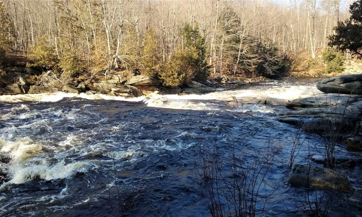
The falls are fairly fast and drop around 10-12 feet. They flow over the flat rocks and empty into a large pool. Not far down stream is the community of Pyrites. The water is a dark brown, being tannin stained from the vegetation on the banks of the river and its tributaries.
For more information, check out-
Northern NY Waterfalls, and St.Lawrence Land Trust.
http://www.stlawlandtrust.org/content/harts-falls
For more photos, go to our Facebook album here:
Slideshow
About the Author
I am a life-long resident of the north country, calling Edwards my home. I have always had a passion for the outdoors, and for local history. I recently started this site to share places that have been part of our local history and heritage. I hope you get a chance to hike some of these trails for yourself and reflect on the rich history of those that walked here before you. And if not, sit back and experience these from where ever you are right now. Either way, enjoy!

1 thought on “Hart’s Falls”